Jurassic Magnetism - 1992 Survey
The following information briefly describes the 1992 deeptow magnetic results from the Pacific Jurassic project. The 2002/2003 results and the most recent 2011 survey collected over the Hawaiian lineations of the Pacific will be added in soon.
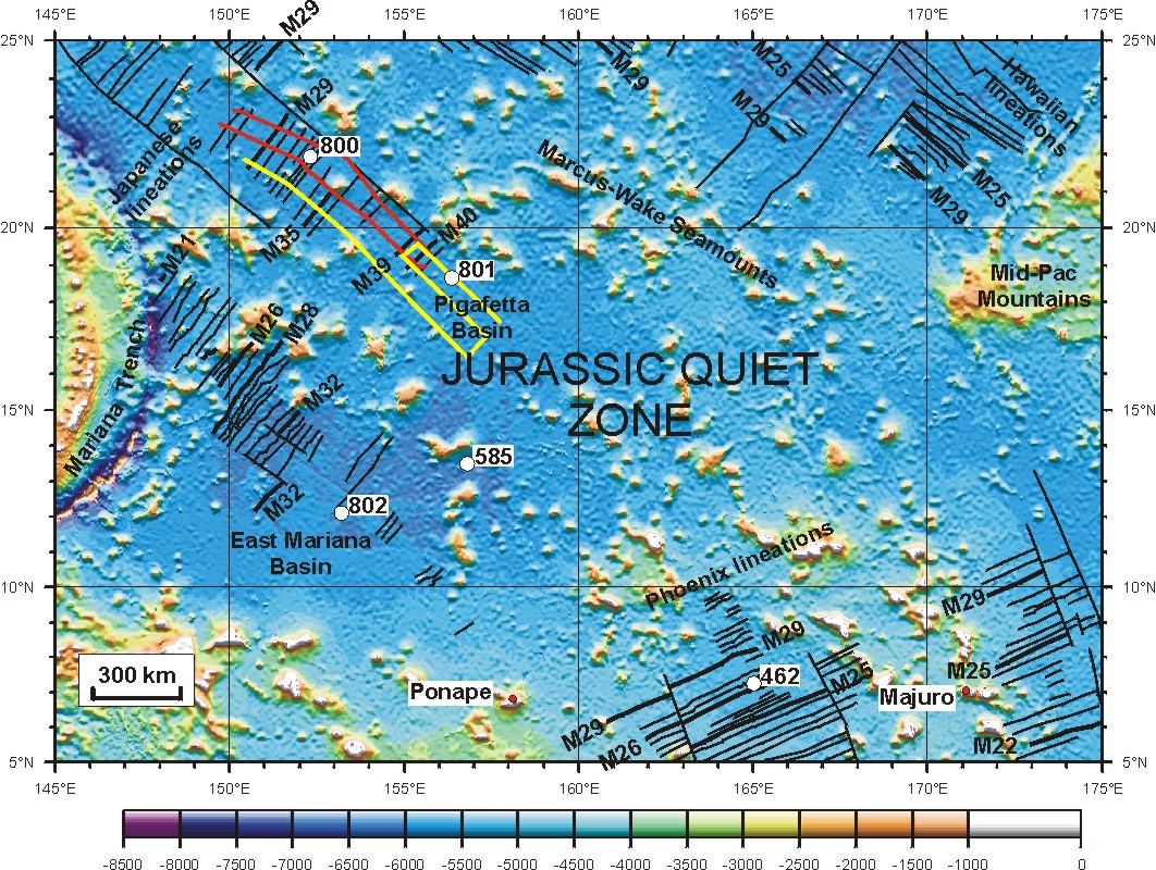
Map of Pacific Jurassic aged crust showing the seafloor depth based on satellite altimetry [Smith and Sandwell, 1997], where dark blue is deep and orange to white is shallow. The three sets of magnetic anomaly lineations are shown by bold black lines: the Japanese to the north, the Hawaiian to the east (right) and the Phoenix lineations to the south. Red line shows the deeptow magnetic profile lines collected in 1992.
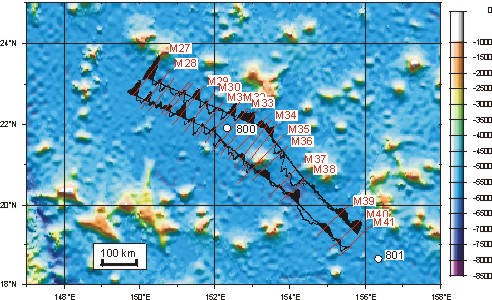
To the right is an expanded scale map of the 1992 Deep-tow magnetic profiles collected in the Pigafetta Basin [Sager et al., 1998]. Again the seafloor depth is shown based on satellite altimetry as in the above figure. The observed deep-tow magnetic anomalies are corrected for depth variations of the tow fish and continued upward to the sea surface. Correlations between the profiles are shown with the red lines with anomaly identifications out to M41. See notes on geomagnetic polarity timescale for age in millions of years. Ocean Drilling Project (ODP) drill sites [Lancelot et al., 1990] are also shown for reference.
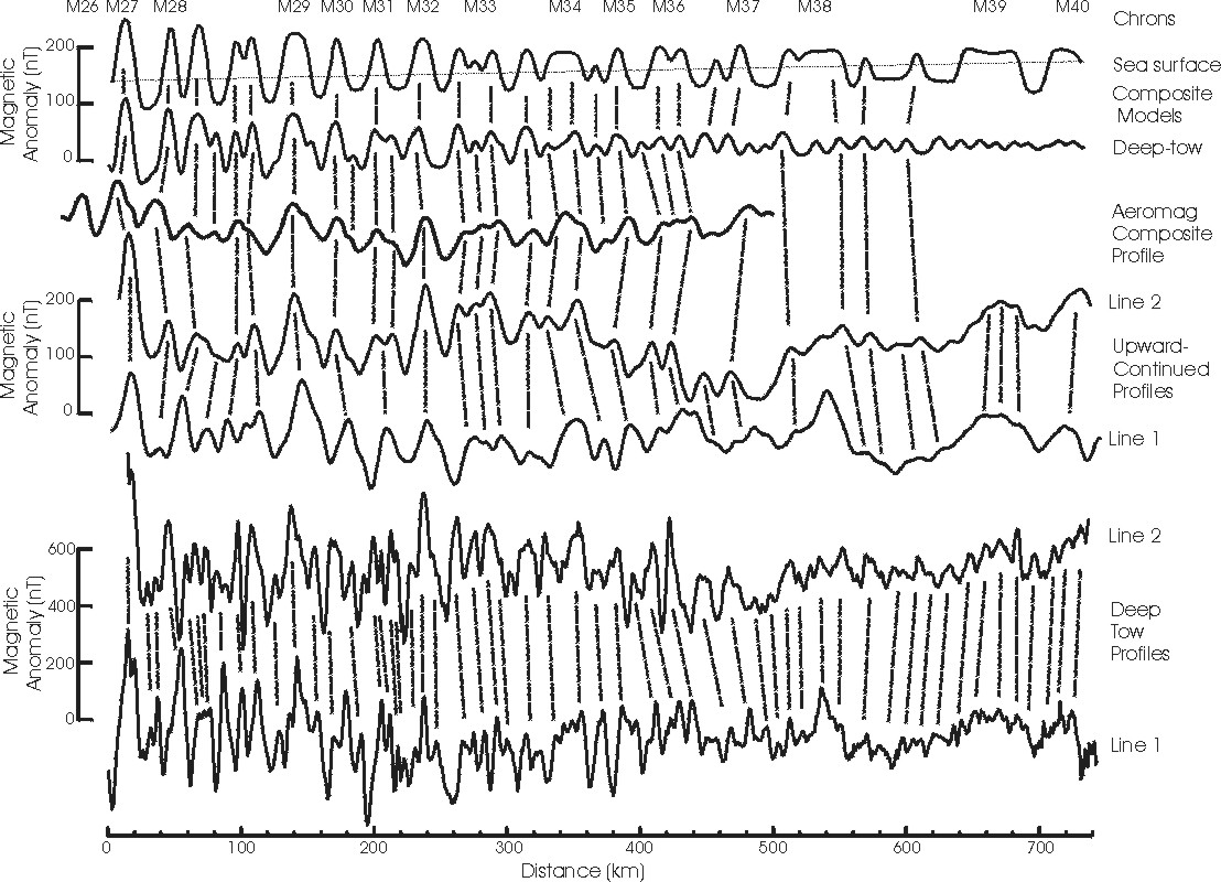
On the right is a plot showing the detailed correlation between the magnetic wiggles of the two 1992 deep-tow magnetic profiles from the Pigafetta basin [Sager et al., 1998]. The bottom panel shows the correlation (dashed lines) between the two 1992 Pigafetta Basin deep-tow magnetic profiles at 4.5 km depth. Middle panel shows the deep-tow profiles upward continued to sea surface level and the correlation with a redrawn version of the composite aeromagnetic profile of Handschumacher et al., [1988]. Top panel shows forward models of sea surface anomaly and near-bottom anomaly. These data have not been deskewed. Figure modified from Sager et al., [1998].
What implications do our results have? Is the JQZ a period of quiet magnetic field activity?
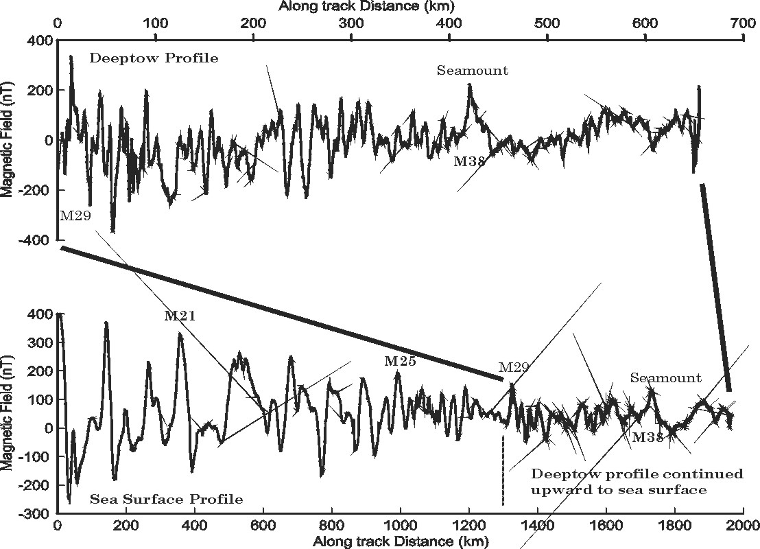
Upper panel of figure displays the near-bottom magnetic field measured along line 1 of the 1992 deep-tow survey and demonstrates the clear decrease in field intensity with age. The bottom panel is a composite sea surface profile (V3214 from Cande et al., 1978) and upward continued deep-tow profile and shows that the trend of decreasing anomaly amplitude with age has continued throughout the late Jurassic for at least 25 m.y.
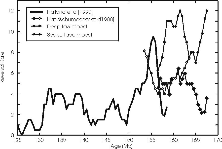
Late-Jurassic to Early Cretaceous magnetic polarity reversal rate calculated for the GPTS of Harland et al., [1990] shown by solid line, and for Handschumacher et al. [1988] shown by white filled circles. These are compared with our deep-tow (black circles) and upward continued (black diamonds) reversal models. The deep-tow model implies an extremely high reversal rate while the more conservative sea surface shows an elevated rate that is consistent with the other time-scales. Reversal rate is calculated at 1 m.y. intervals with a 2 m.y. window and is based on a figure from Sager et al. [1998].
